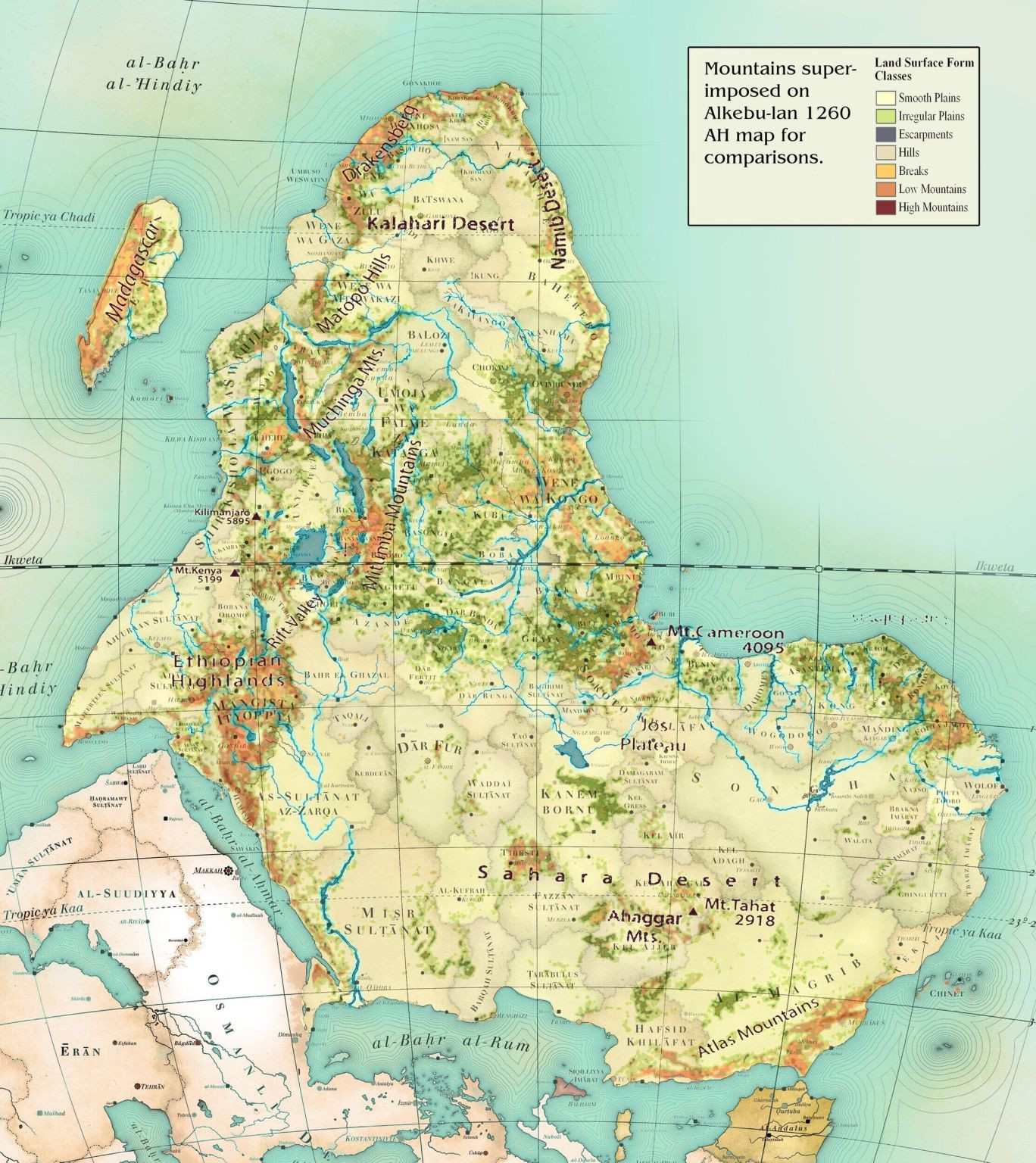
The Alkebulan map is an ancient map of Africa that was created by the Moors of Morocco during the Middle Ages. It is said to be the oldest map of Africa, as its earliest known version dates back to the 15th century. The map shows the continent in its entirety, with the Nile River running through its centre. The map is divided into several sections and features precise details of various locations.
The Alkebulan map is very different from the modern-day map of Africa found in textbooks today. Firstly, the Alkebulan map does not include the nations of Morocco, Algeria, Tunisia, or Libya. Secondly, the map does not divide Africa into countries, as current maps do. Instead, the map includes regions, cities, and towns that were prominent at the time it was in use. Additionally, the map includes geographical features such as rivers and mountains, as well as information about the flora and fauna of the continent.


Kemet Alpha
Verwijder reactie
Weet je zeker dat je deze reactie wil verwijderen?