MY comment is the one with the emoji in response to what the sistah stated. DO NOT 'like' this post. PLEASE COMMENT YOUR THOUGHTS BELOW.

Like
Comment
Share
MY comment is the one with the emoji in response to what the sistah stated. DO NOT 'like' this post. PLEASE COMMENT YOUR THOUGHTS BELOW.


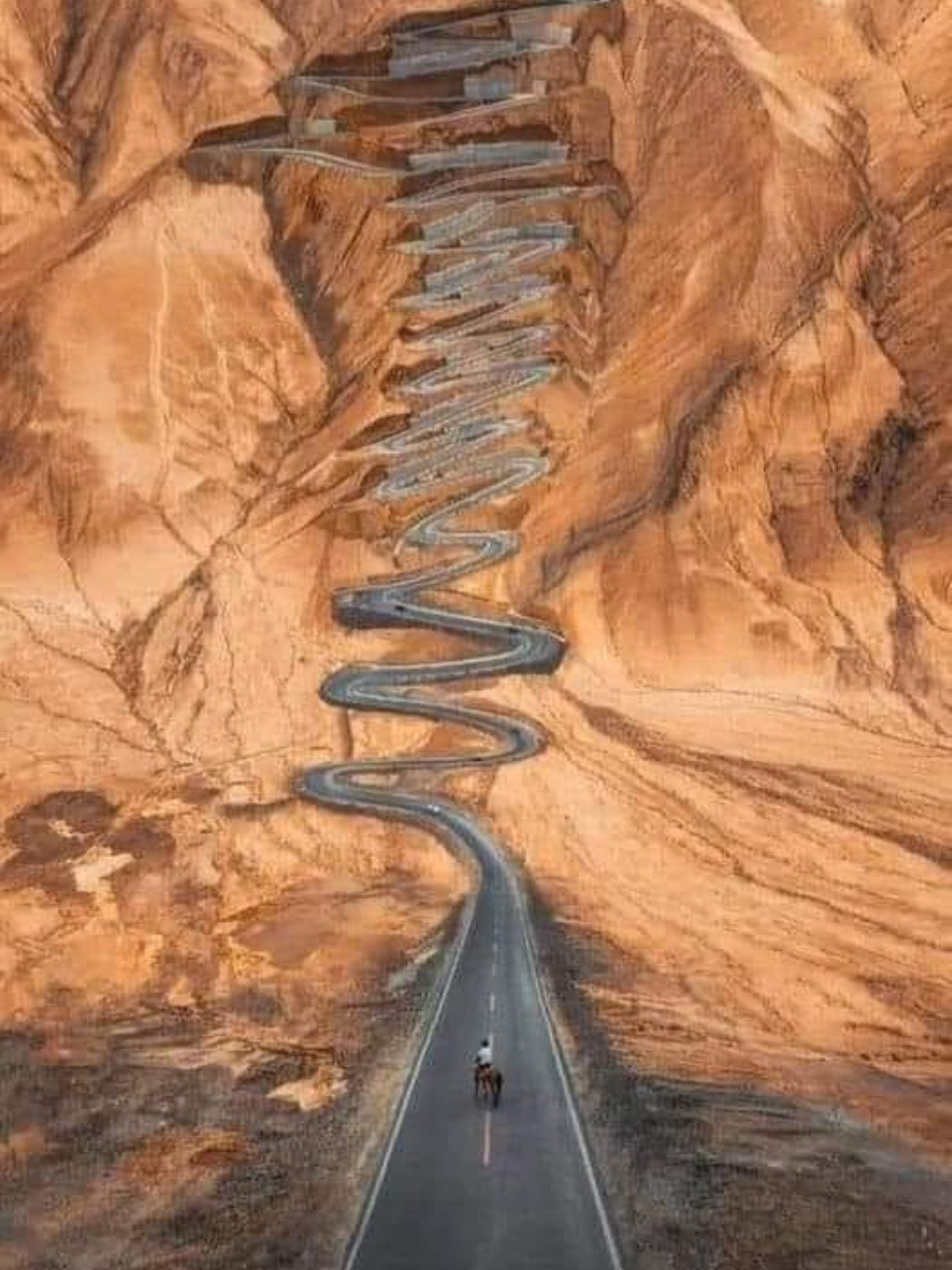
Why Does The Road Curve? Because Your Mind Is Too Fragile To Handle All That Lay Ahead Of You.
Karakoram Highway connecting Pakistan to China,
known as the "Friendship Road" by the Chinese. It connects Pakistan to China through the Karacorum ridge.
Cross the Khunjerab Pass at an altitude of 4,964 meters (second highest in the world).
Its construction began in 1959 and it was completed 27 years later. Karakoram is a dum feature of engineering to me. It is 1300 kilometers across three mountain ranges in the Himalayas and Hindukush.
👀
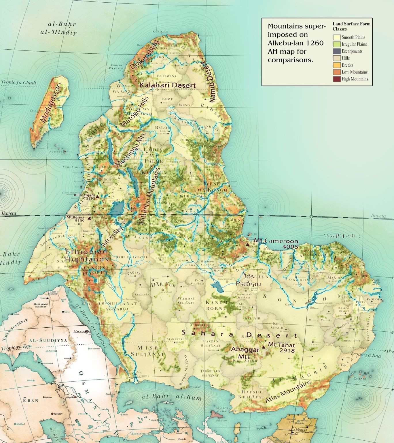
The Alkebulan map is an ancient map of Africa that was created by the Moors of Morocco during the Middle Ages. It is said to be the oldest map of Africa, as its earliest known version dates back to the 15th century. The map shows the continent in its entirety, with the Nile River running through its centre. The map is divided into several sections and features precise details of various locations.
The Alkebulan map is very different from the modern-day map of Africa found in textbooks today. Firstly, the Alkebulan map does not include the nations of Morocco, Algeria, Tunisia, or Libya. Secondly, the map does not divide Africa into countries, as current maps do. Instead, the map includes regions, cities, and towns that were prominent at the time it was in use. Additionally, the map includes geographical features such as rivers and mountains, as well as information about the flora and fauna of the continent.
Dang! 😯

I’m glad y’all learned the word “narcissist” this year
Now learn “accountability”

Rise Up This Mornin, Smile With The Risin ☀️
Not all demons have horns... Some of them got big tiddies 🤨